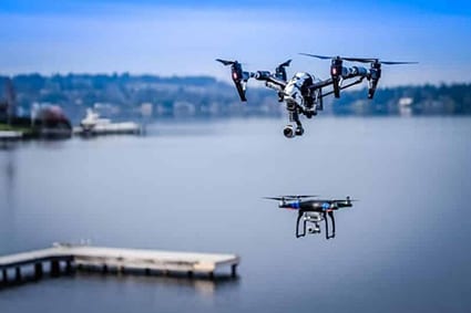
AERIAL FILMING, PHOTOGRAPHY, 3D MAPPING, SURVEYING & INSPECTION

Add a new dimension to your project and transport the audience from one place to another. Our drone services include aerial filming, photography, 3d mapping, and land surveying. The camera can now fly up close and personal and offer you that “impossible” view.

Videography-photography-drone-photography-filming

Aerial Filming & Photography

We provide you with a wide range of services in Aerial Photography and Filming. We are certified and FAA licensed drone pilots insured and bonded. The camera can now fly up close and personal and offer you that “impossible” view.
Free Consultation & Pricing
real-estate-phtography

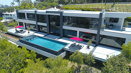
Real Estate Filming & Photography

In real estate, professional pictures are worth more than a thousand words, they can be worth thousands of dollars. Marketing a home can be an expensive undertaking, but allocating a budget for professional photography and videography ensures your marketing dollars are getting you the return on investment. Regardless of price range or condition, listings with photos and video generate more interest and sell in fewer days at a higher price.
Pricing
agriculture-drone-photography

Agriculture

Capture field images and generate maps. Drive down costs and increase profits by avoiding crop loss. Live Map is the ultimate current-condition crop scouting tool.
Free Consultation & Pricing
construction-drone-photography

Construction

From Site Selection to Ribbon Cutting Manage, Measure, and Monitor Projects with Drone Imagery. Keep Projects on Track with a Real-time Visual Record.
Free Consultation & Pricing
mapping-inspection-drone-photographjy-sueveying

Mapping for Inspection

Whether you’re inspecting a new building or investigating an insurance claim, it’s important to capture accurate data quickly. Drone mapping is a powerful new tool for inspection allowing you to safely and easily capture a high-resolution aerial view of a site in minutes.
Free Consultation & Pricing
mapping-inspection-drone-photography

Mapping for Solar Panel Installation & Inspection

Quickly and safely inspect and measure roofs with drones. Automatically collect high resolution roof imagery and generate comprehensive roof reports 3x faster than traditional methods.
Free Consultation & Pricing
roof-inspection-drone-photography

Roof Inspections & Measurements

Quickly and safely inspect and measure roofs with drones. Automatically collect high resolution roof imagery and generate comprehensive roof reports 3x faster than traditional methods.
Free Consultation & Pricing